


Asbury United Methodist Church, Shelby County, Alabama
About
Outline

Summary
| Unique Area Identifier | 522901 |
| Name | Asbury United Methodist Church |
| County | Shelby County |
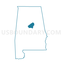
| State | Alabama |
| Area (square miles) | 13.19 |
| Land Area (square miles) | 12.93 |
| Water Area (square miles) | 0.26 |
| % of Land Area | 98.04 |
| % of Water Area | 1.96 |
| Latitude of the Internal Point | 33.35050290 |
| Longtitude of the Internal Point | -86.70249110 |
Maps


Graphs
Select a template below for downloading or customizing gragh for Asbury United Methodist Church, Shelby County, Alabama


Neighbors
Neighoring Voting District (by Name) Neighboring Voting District on the Map
- Faith Presbyterian Church, Shelby County, AL
- Hoover Fire Station #8 (Greystone), Shelby County, AL
- Meadowbrook Baptist Church, Shelby County, AL
- New Hope Cumberland Presbyterian Church, Shelby County, AL
- North Shelby Baptist Church, Shelby County, AL
- Pelham Civic Complex, Shelby County, AL
- Sports Blast Shelby County, Shelby County, AL
- The Church at Brook Hills, Shelby County, AL
Top 10 Neighboring County Subdivision (by Population) Neighboring County Subdivision on the Map
Top 10 Neighboring Place (by Population) Neighboring Place on the Map
- Hoover city, AL (81,619)
- Pelham city, AL (21,352)
- Chelsea city, AL (10,183)
- Meadowbrook CDP, AL (8,769)
Top 10 Neighboring Unified School District (by Population) Neighboring Unified School District on the Map
Top 10 Neighboring State Legislative District Lower Chamber (by Population) Neighboring State Legislative District Lower Chamber on the Map
- State House District 41, AL (73,181)
- State House District 43, AL (56,056)
- State House District 48, AL (54,047)
Top 10 Neighboring State Legislative District Upper Chamber (by Population) Neighboring State Legislative District Upper Chamber on the Map
Top 10 Neighboring 111th Congressional District (by Population) Neighboring 111th Congressional District on the Map
Top 10 Neighboring Census Tract (by Population) Neighboring Census Tract on the Map
- Census Tract 303.30, Shelby County, AL (5,410)
- Census Tract 303.31, Shelby County, AL (4,399)
- Census Tract 303.45, Shelby County, AL (2,865)
- Census Tract 303.44, Shelby County, AL (2,849)
- Census Tract 303.42, Shelby County, AL (2,624)
- Census Tract 9800, Shelby County, AL (37)